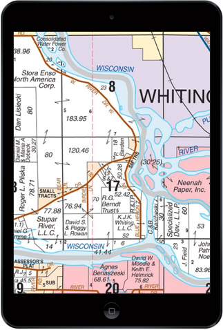
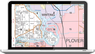
eBook is a digital county plat map (.pdf) identical to the printed plat book with the exact same maps, content, and data. Designed for use on any computer, smartphone, or tablet device with .pdf viewer software such as Adobe’s free Adobe Acrobat Reader.
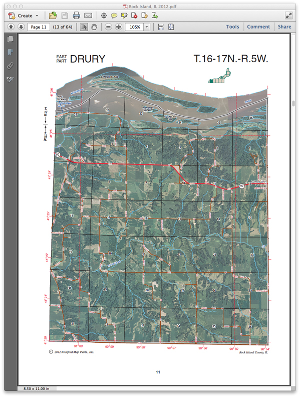
File Format: .pdf Commom Supporting Software:Adobe Acrobat Reader File size: 20-95 MB per county Color: Availability varies by county and edition Georeferenced: No Multi-layered: No Attributed: No Includes Aerials: Most editions published after 2009 have facing-page aerials. *All editions published since 2017 include 3D aerials! Includes License:Lifetime Site License – included in price, no renewal fee Delivery Time: Same business day if ordered by noon CST
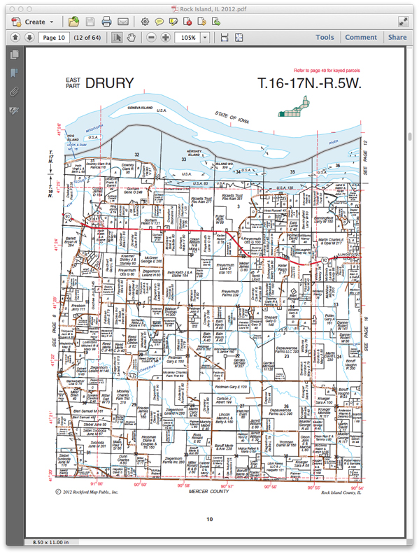
PLEASE NOTE: Historical printed and digital map products from Rockford Map are reproduced from our original library of maps. Many of the original maps were hand drawn and will show imperfections, light and dark areas, smudges and other discolorations. Though we strive to maintain the original print condition of all our maps, deterioration caused by aging does occur. Rockford Map can restore any of its historic map data to a higher resolution according to your specific request. Please contact us to discuss your needs in more detail.