Digital Plat Map Product Comparison

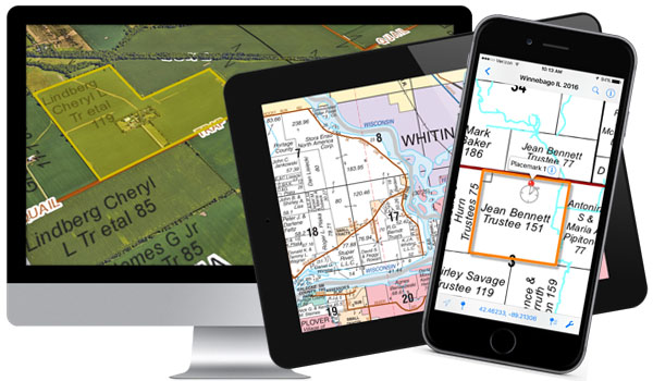
Rockford Map Publishers offers a wide variety of digital plat map products that focus on county land ownership information. Regardless of industry or intended use, we have a product that is right for you! Our digital map products offer the same county overview you would get from a plat book, but with added features and benefits!

You can rely on our unparalleled accuracy, quality, and commitment to providing nationwide land ownership information in the formats you require. Take a look below at the product comparison charts. These charts should help you distinguish the main differences between each type of digital county file that we offer:

Digital Maps

Everyday User

These products are recommended for everyday plat book users. The base map content is the same as the plat book, but each file has a slightly different application and delivery depending on your need. eBooks look just like the plat book, but come in the form of a digital .pdf. MobilePlat is a seamless .pdf of the entire county and offers geolocation ability when used on your mobile device. GeoPlat also offers a seamless view of the county, but is designed to be imported and used within Google Earth. All three products in this category contain a Lifetime Site License. The Lifetime Site License allows you to share the file within your site location (like an office). You can put the file on multiple devices as well as print out individual pages. The license does not need to be renewed and is valid for as long as you retain the file. These are the only digital products that come bundled with a Lifetime Site License.
eBook
MobilePlat
GeoPlat
File Format
.pdf
.pdf
.kmz
Software/App
Adobe Acrobat
Avenza Maps app
Google Earth
Georeferenced    
Includes Aerials
Can access via app
Can access via app
Town & Range    
License
Lifetime Site License
Devices
Desktop + Mobile
Desktop + Mobile
Desktop

Advanced User

These files contain the same base map information as the plat book, but are more application specific. Image File is best for if you need to insert individual townships into marketing documents and corporate literature. RMP SmartImage and Vector File are cost-effective parcel data alternatives that can be used in GIS Software. Image File and RMP SmartImage are available for every new county update. Vector Files are only available for a limited number of new county updates. Check the individual county pages for availability.
Image File
RMP SmartImage
Vector File
File Format
.tif
.tif
.dwg or .dxf
Software/App
Graphics software
GIS software
GIS software
Georeferenced    
Includes Aerials
Town & Range  
License
One-year license     
One-year license     
One-year license     
Devices
Desktop
Desktop
Desktop

GIS User

Parcel Shapefile Data is the product for you if you are in need of more information than what the plat book provides. Our fully attributed parcel polygon data contains information such as PINS (Parcel ID), Ownership Information, Addresses and other related attributes. These files are intended to be used in GIS software like ArcMap or Google Earth. Pricing depends on available attributes and varies by county.
Parcel Shapefile Data
File Format
.shp or .kml
Software/App
GIS Software
Georeferenced
Includes Aerials
Town & Range
License
Standard License
Devices
Desktop

Recent Posts